Adventures
Alameda Creek Regional Trail | Explore California
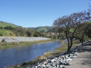
This is a flat 4.5-mile hike with multiple route options and wildlife viewing possibilities, suitable for the whole family, all year round.
This is a flat 4.5-mile hike with multiple route options and wildlife viewing possibilities, suitable for the whole family, all year round.
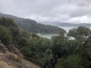
Until about ten thousand years ago, Angel Island was connected to the mainland, and cut off by the rise of the sea level after the Ice age ended.
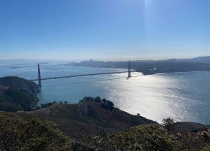
This Marin Headlands trail is a beautiful hike in the Marine Headlands park that features great views on San Francisco Bay , Alcatraz, Angel Island
Located in Alameda County, near the town of Sunol, south of Pleasanton and east of Fremont , the Sunol-Ohlone Regional Wilderness park is best discovered
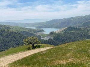
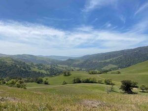
Nestled in the hills east of Gilroy, Coyote Lake Harvey Bear recreational area is best discovered in February and March . Bountiful green hills with cows grazing peacefully, carpets of wildflowers dispatched along the trails, gorgeous views above the lake , cool oak forests and breezy ridge lines will all add to this gorgeous hike and give you real energy boost .
Marshall Beach is a secluded beach in the Presidio Park in San Francisco. You can go to this San Francisco hike from 101 and exit at