Point Lobos Loop Trail: California’s Natural Treasure
Explore the scenic Point Lobos Loop Trail, situated near the charming town of Carmel-by-the-Sea in California. This captivating trail spans 8.06 miles and is known for its ease, making it accessible to hikers of various skill levels. On average, it takes around 3 hours and 30 minutes to complete, providing ample time to soak in the breathtaking surroundings.
The area is a haven for birding enthusiasts, hikers, and runners, so expect to encounter fellow nature enthusiasts during your journey. Open year-round, this trail offers a timeless beauty, welcoming visitors in any season. Please note that dogs are not allowed on this trail, so it’s best to leave your furry friends at home.
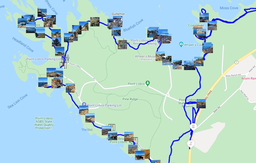
Point Lobos Loop Trail Map
You can find Point Lobos Loop Trail map and adventure on the FREE duoveo app with all the essential details here. The app provides valuable information about facilities, picnic areas, restrooms, and parking spots along the trail with its Icons.
Point lobos Trail Details
Route type: Loop
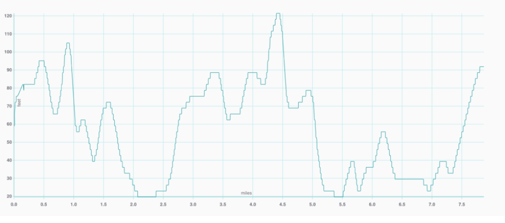
Elevation gain: 626.24 ft
Trail level: Easy
Length: 8.06 miles
Trail starting point: Point Lobos, Carmel-By-The-Sea, CA 93923, USA
If you come across a volunteer guide, inquire about recent whale sightings. If there have been any, consider finding a spot along the trail to observe their spouts.
To avoid crowds, plan your visit on a weekday and park closer to the coastline.
Allow yourself two and a half to three hours for the drive from San Francisco, taking Highway 1 south from Pacifica. For those coming from Silicon Valley, take Route 17 south from San Jose and connect to Highway 1 south in Santa Cruz.
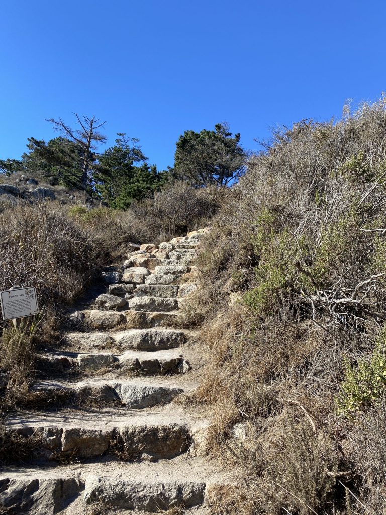
Stay alert for poison oak along narrow trails.
Entrance Fees (Summer 2010):
Passenger cars: $10
Vehicle with a senior citizen: $9
Disabled discount: $6
Essential Items to bring:
Layered clothing and a windbreaker due to strong and chilly Pacific breezes.
Water and snacks, with a picnic lunch being a great option.
Camera to capture the stunning scenery.
Binoculars for a closer look at wildlife and scenic vistas.
Coastal Adventure at Point Lobos: Exploring California's Natural Treasure
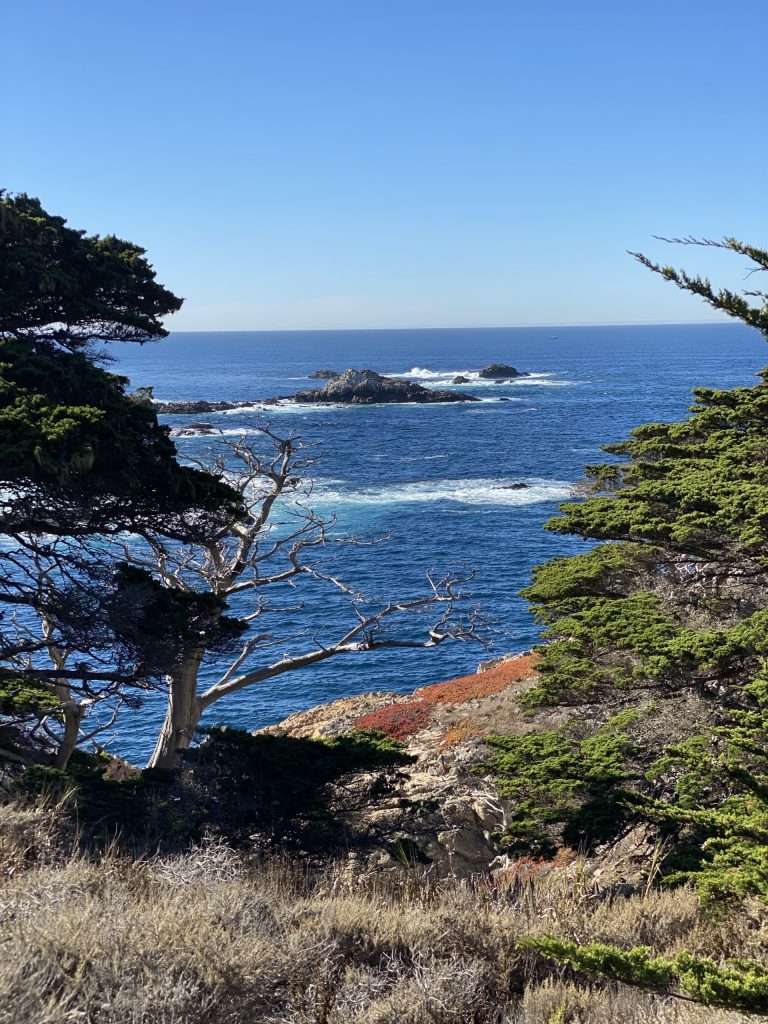
Point Lobos State Natural Reserve, often hailed as the “crown jewel of the State Park System,” boasts the remarkable Point Lobos Loop Trail in California. This trail offers an exceptional array of activities, from sightseeing and photography to nature study and picnicking. Adventurers can even indulge in SCUBA diving and jogging amid the breathtaking scenery.
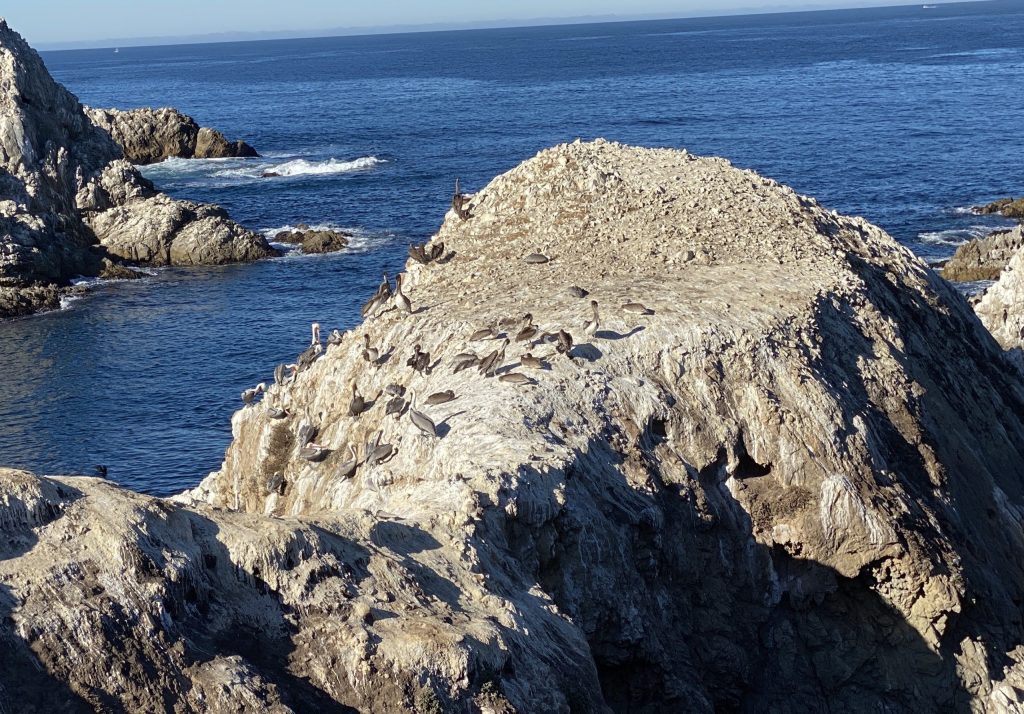
The reserve’s headlands, coves, and rolling meadows create a picturesque landscape, while the offshore waters boast one of the world’s richest underwater habitats, making it a diver’s paradise. Wildlife enthusiasts will be delighted by sightings of seals, sea lions, sea otters, and migrating gray whales from December to May. Thousands of seabirds also call the Reserve their home, adding to the vibrant wildlife.
As you explore this must-see destination along the popular West Coast Highway 1, you’ll encounter endangered archaeological sites, unique geological formations, and an abundance of diverse flora and fauna, both on land and in the surrounding seas.
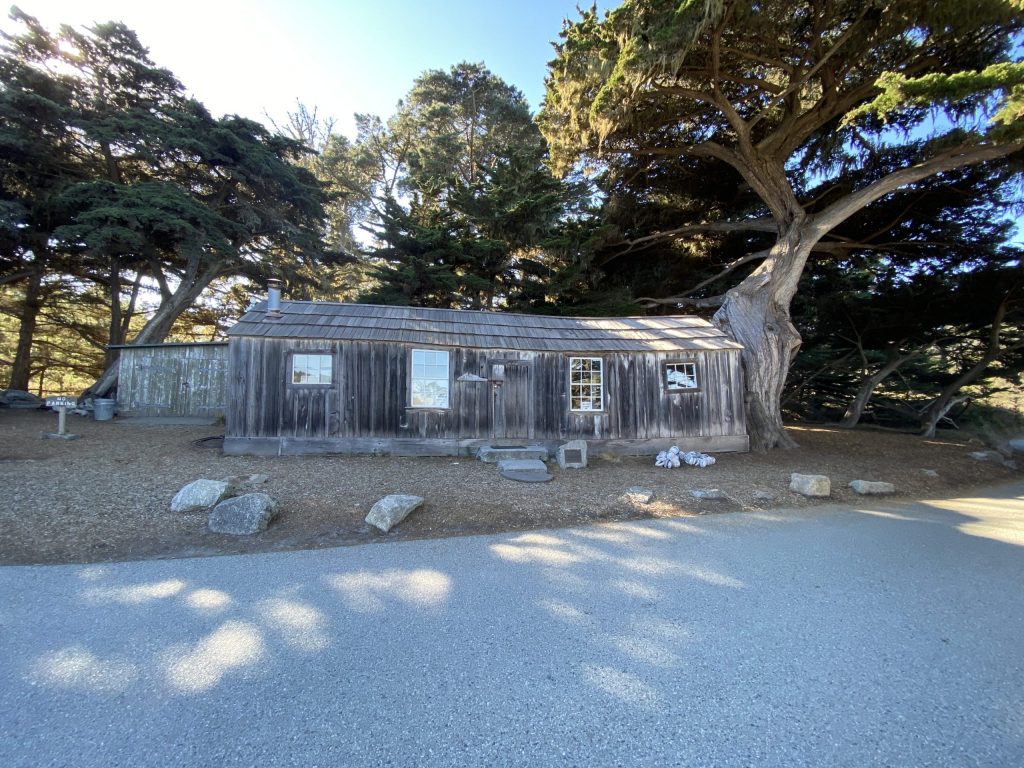
Additionally, Point Lobos holds a fascinating historical significance, once serving as the site of a turn-of-the-century whaling and abalone industry. A cultural history museum now stands at Whalers Cove, preserving the memories of its past.
For an immersive experience in this natural wonder, our duoveo app allows you to capture stunning pictures and access helpful maps, ensuring you make the most of your Point Lobos adventure. Prepare to be enchanted by the unparalleled beauty and diverse offerings of this remarkable coastal reserve.
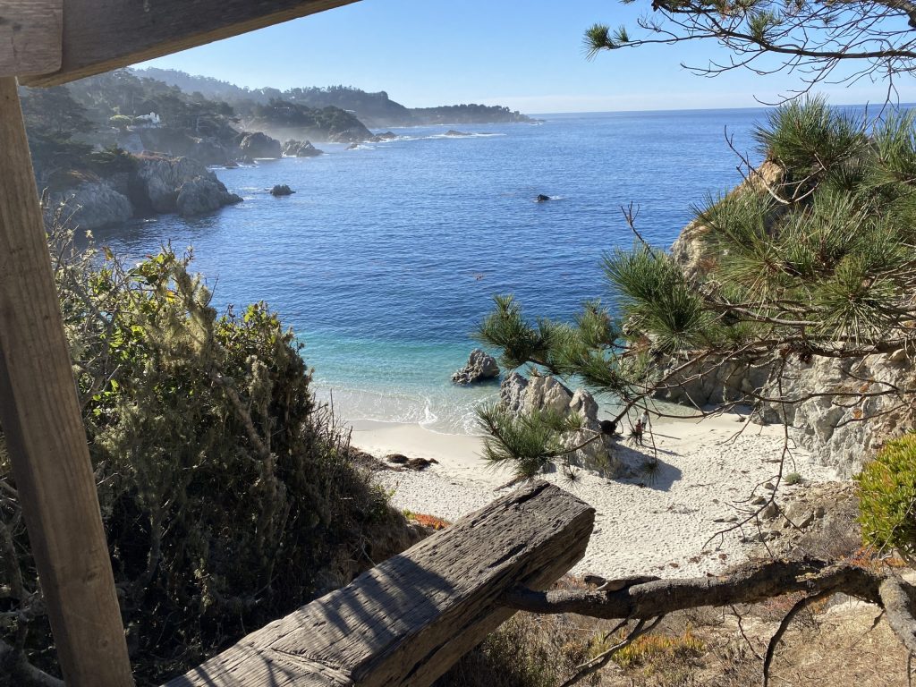
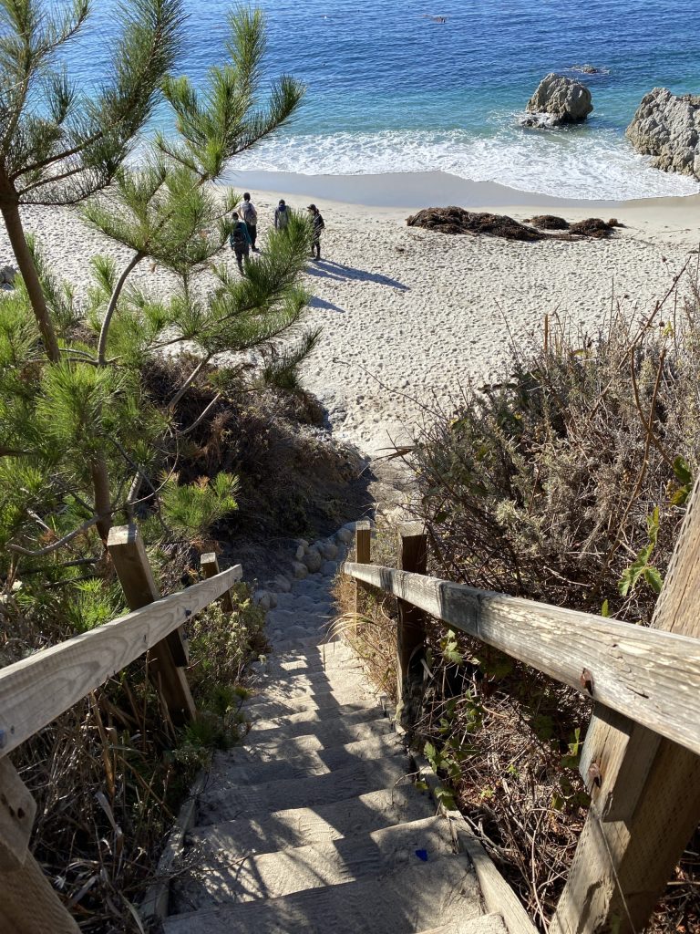
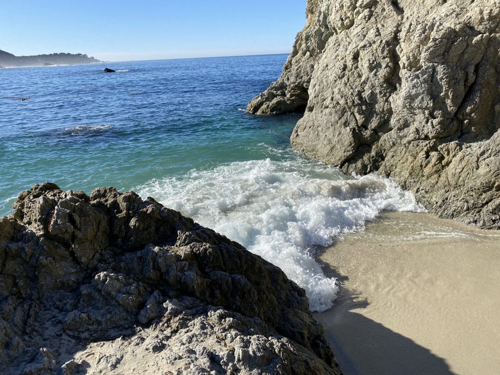
Gibson Beach and Bird Island
Gibson beach is very secluded due to the difficulty of accessing the beach. It is a quarter-mile walk and a downhill climbing on the steep stairs from the south plateau parking lot. Bird Island is just offshore. So, you can best view it from Pelican Point via a short trail just south of China Cove. To get here, go to the very end of the park road. Then, walk out on the Bird Island Trail which has steps that lead down to the beach.
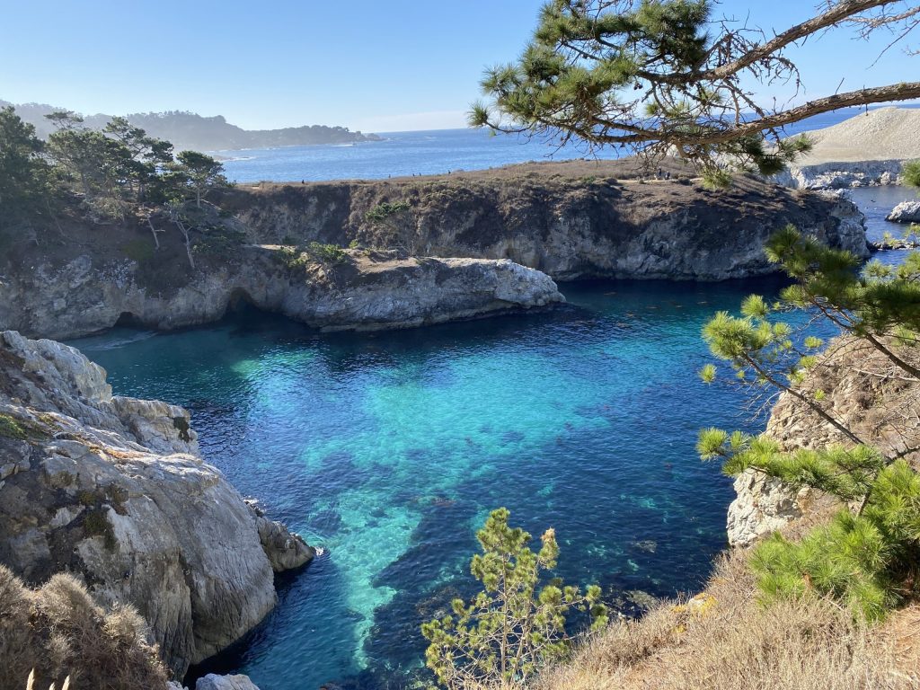
Emrald Sea at China Cove
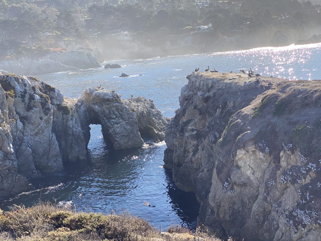
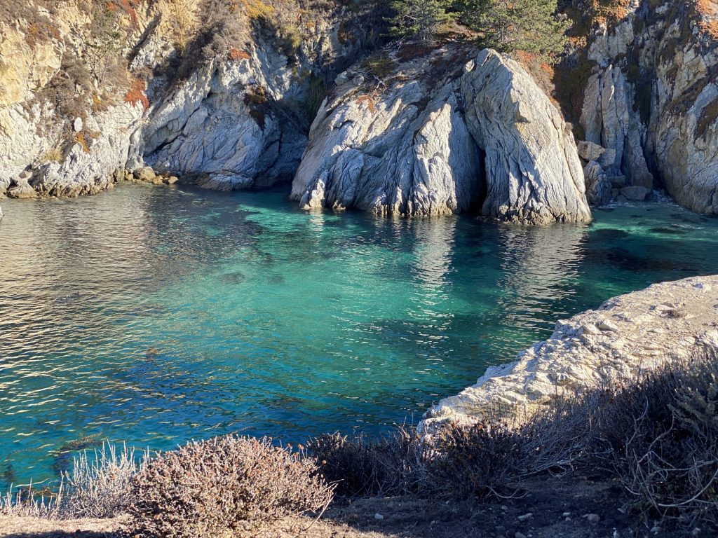
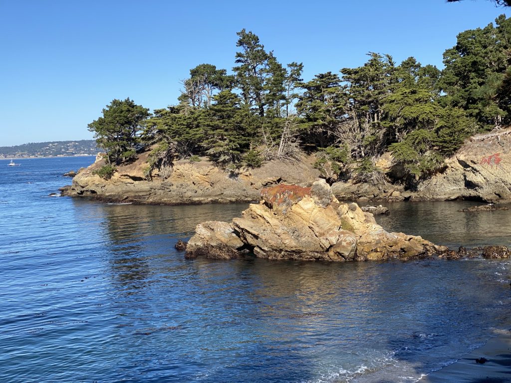
China Cove is an emerald green cove with a tiny pocket beach and is a must-see of this Point Lobos Loop Trail. It’s a narrow deep sandy beach surrounded by rock walls. At low tide, you can find a small cave and a rock arch in the south wall.
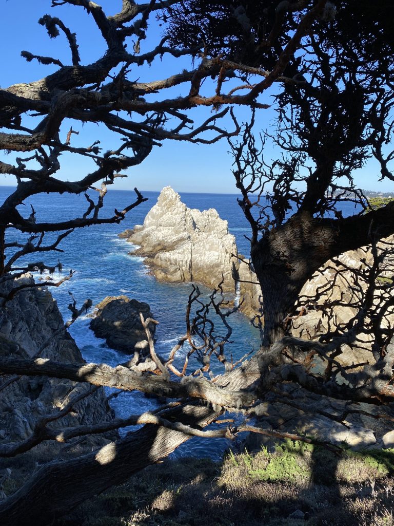
Sea Lion Point Trail
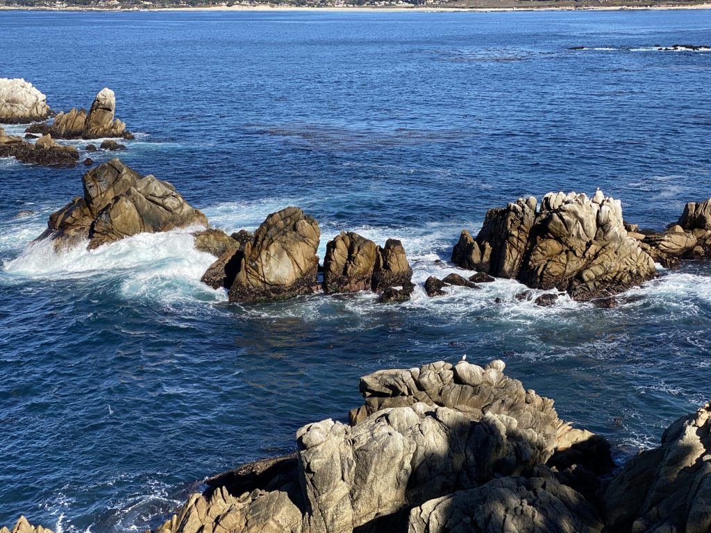
Point Lobos derives its name from the offshore rocks at Punta de Los Lobos Marinos, Point of the SeaWolves. From there, the sound of the sea lions carries inland. Inside this Point Lobos Loop Trail you can follow the Sea Lion Point Trail that includes cove overlooks and offers the best view of sea lion rocks offshore. It is a 0.6 mile round trip from the Sea Lion Point parking area. The upper part of the trail connects with the Sand Hill Trail to make a loop around Sand Hill that is fully accessible. Lower portions of this trail are not accessible.
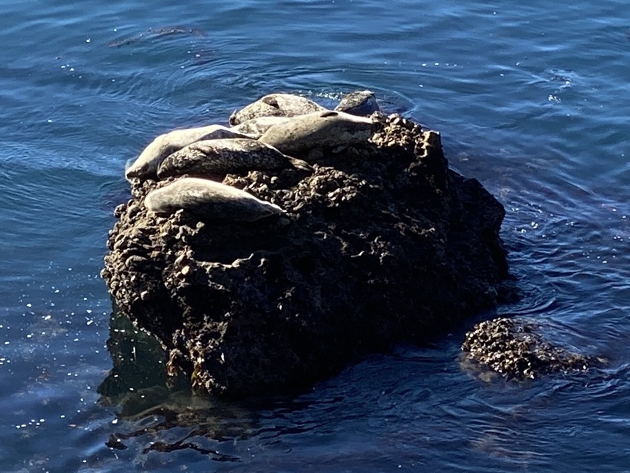
This trail forms, along with a section of the Sand Hill Trail, a fully accessible loop of stunning ocean views. First, it begins under the cypress trees on the west side of the Sea Lion Point parking lot. Then, go right at the fork and head directly toward the ocean. Next, this takes you through one of nature’s seaside gardens to a magnificent ocean view. On the way, ground squirrels scurry and sparrows perch on bushes to sing. After this, on the right in Headland Cove, look for sea otters in the kelp and for harbor seals that sometimes bask on the low rocks across the cove at the water’s edge.
In Sea Lion Cove, look again for hauled-out harbor seals just below you. Indeed, this spot is often staffed by a docent with a spotting scope who is eager to show you close-up views of the animals.
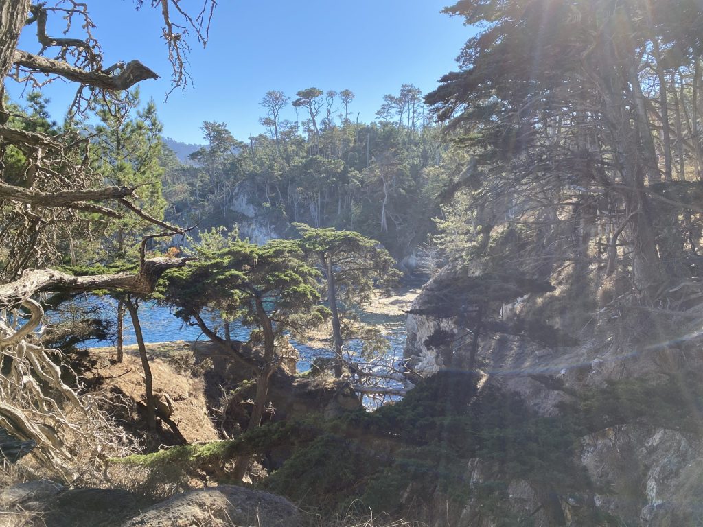
Cypress Grove Trail
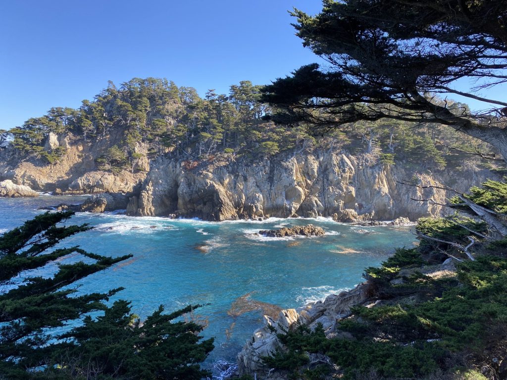
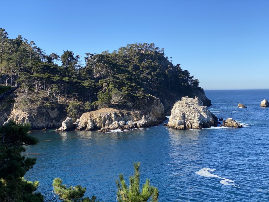
Cypress Grove Trail is one of the most popular hikes at Point Lobos and for good reason! This short, clifftop loop takes you through dense cypress groves like the Allan Memorial Grove and also near several coves with gorgeous coastal views. Moreover, the California hike trail is a relatively flat, leisurely stroll under the thick canopy of Monterey Cypress. Definitely, Point Lobos is one of only two places in the entire world where you can find native Monterey Cypress (the other being Pebble Beach, CA), as they prefer moist areas constantly surrounded by fog.
North Shore Trail
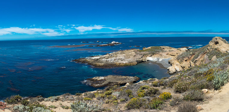
This trail is well worth the effort for hearty walkers with strong legs. Still, exposed to prevailing northwesterly winds and seas, this rugged headland of sheer-walled coves and changing plant communities offer surprises at every turn. Furthermore, note the dramatic cliffs of granodiorite, slowly carved through the ages by the pummeling of the relentless surf. Altogether, this California hike trail affords several views into several coves including Bluefish Cove – often with seals, otters, and egrets.
At the eastern end, Cannery Point offers good views across Carmel Bay and Whalers Cove. In spring and summer, one can see nesting western gulls, pigeon guillemots, and both Brandt’s and pelagic cormorants on Guillemot Island. A side trail at about the midpoint of the trail is the best spot to watch these birds. Up the next rock staircase (quite long and uneven) you can go straight for a short distance out to a couple of very fine viewpoints. Then, the North Shore Trail turns left at the top of the stairs. So, soon you see a spectacular view from high above Whalers Cove.
As a final point, the choice is yours in Point Lobos. You can walk little loops from each parking lot or park along the way 1 and hike the whole 8-mile loop. In any case, you won’t be disappointed.
Looking for other Californian hikes? Discover our hike ideas: